Colorado Unit 65 archery

a.gow56@gmail.com

New member
Jul 15, 2019
2
Hi Everyone!


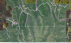
A friend and I are heading to the Ouray area to hunt elk the last 10 days of archery season this fall. I know the mountains are huge and conditioning is key. Wondering what people think of the roads in the area, do we need an ATV? Is it tough to get away from the crowds? We are planning on hiking in a long distance. Any other tips for the area are much appreciated! Feel free to PM.


Thanks!
 
All I know is that area will be a shit show this year due to all of the avalanche activity this past winter.

The San Juans got hit super hard and I'd image that there will be a lot of trees blocking access on many trails in that area this year.

That being said, I did hunt 65 a bit further north in the Unit last year a couple weekends and did see some elk, but never got close enough.
 
Go east of Ridgway over Owl Creek Pass. After you go over the pass, stay on the main road until you see a sign that says Turrent Ridge. Park there and go straight up the mountain to your left. Believe it or not, but the 10,000 ft. contour line on your map is an elk trail that goes from one meadow to another all along the back face of the ridge..
 
ag56,


How did your hunt turn out? I've hunted 65 a couple of times and I'm planning on going back this year.
 
2 of us are planning on Archery elk in CO unit 65 this year. How is the motorized trail system? Would we be better off taking two quads or one SXS? We would just use them to get to a good hike in point. Not planning on hunting near them.
We took 2 quads to unit 76 last year and without them we would have spent hours of walking while others rode by.

Sent from my SM-G950U using Tapatalk

 
MISurveyor,


Attached is screen shot of some the roads around the northern part of 65 near Ouray.
 

Attachments

  • Northern 65 Rosds.PNG
    Northern 65 Rosds.PNG
    2.7 MB · Views: 14
AJHURD said:
MISurveyor,


Attached is screen shot of some the roads around the northern part of 65 near Ouray.
Thanks. I have OnX and last year we found several times trail info from OnX didn't match the actual trail signage. I have now found that OnX Offroad has different info than the Hunt version.
I would rather take a SXS but don't want end up finding most trails having 50" width restrictions.


Sent from my SM-G950U using Tapatalk

 
If you take a look at the CPW Hunt Atlas, you can turn on a map layer that shows the motor vehicle usage for the area. Here is a link to the site:  https://ndismaps.nrel.colostate.edu/index.html?app=HuntingAtlas


The map layer is in the top left corner.
 
Thanks. I guess I should have checked the prime source. Based on that map many of the trails are 50" or less. Looks 4 wheelers again this year.

Sent from my SM-G950U using Tapatalk


Members online

No members online now.

Latest posts

Back
Top